Development and provision of scenario maps on water erosion with EROSION-3D for arable land in Saxony, as a basis for the planning and implementation of erosion control measures (R&D project)

Saxon State Office for Environment, Agriculture and Geology (LfULG)
GeoGnostics
Erosion modelling
2018 - 2020
Project report: "Szenarien-karten Wassererosion in Sachsen" LfULG publication series: https:// publikationen.sachsen.de
Maps: iDA data portal of the LfULG: www.umwelt.sachsen.de/ umwelt/infosysteme/ida
Project background
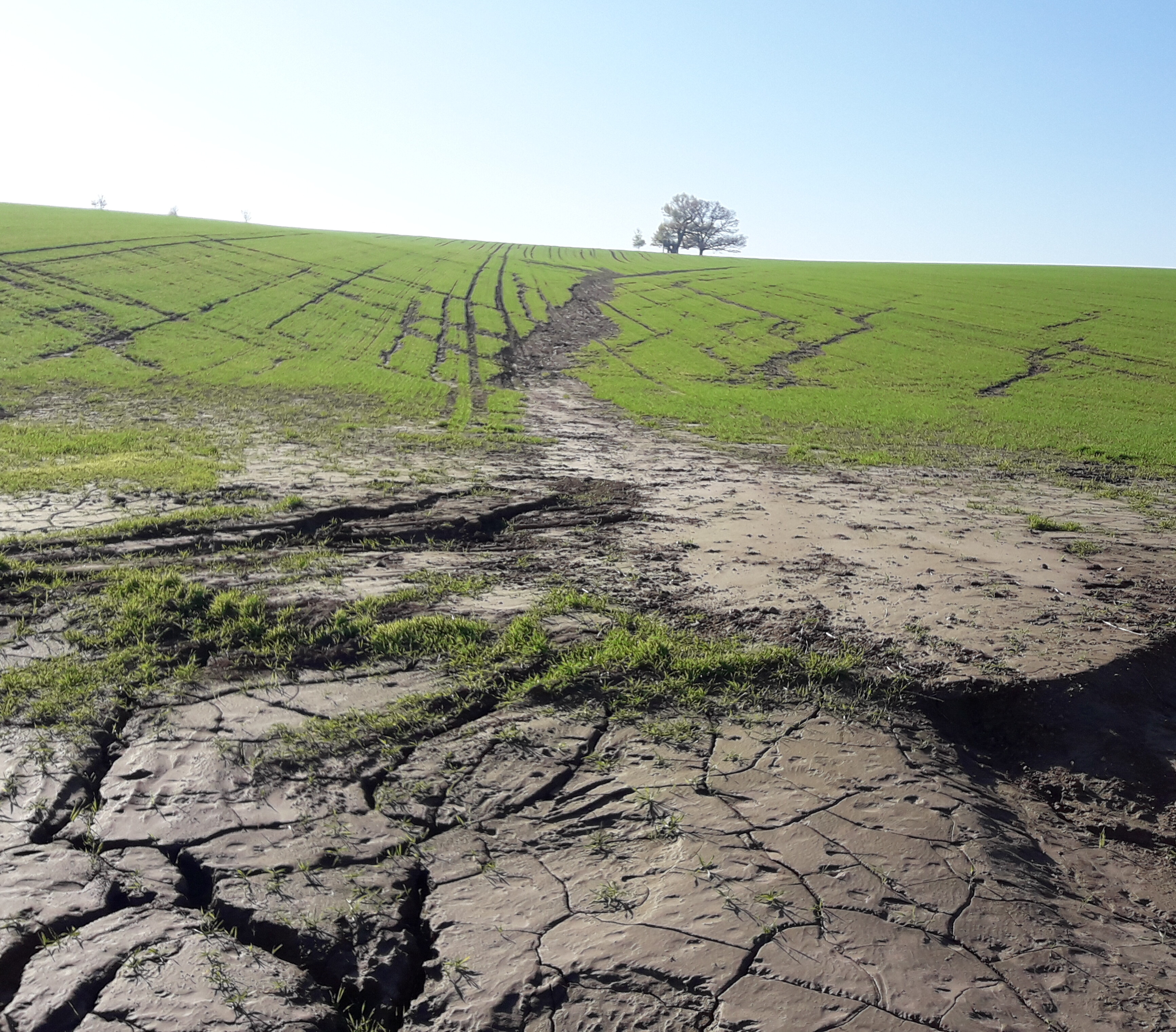
The risk of rainfall-induced soil eros-ion on arable land in Saxony is heigh-tened by the widespread presence of siltrich soils combined with sloping terrain.
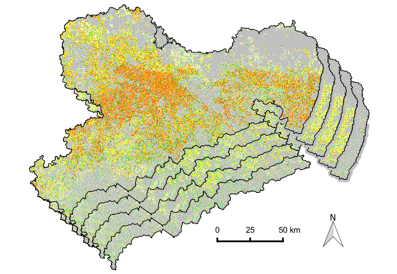
As part of the R&D project, state-wide scenario maps on soil erosion using EROSION-3D were created on behalf of the Saxon State Office for Environ-ment, Agriculture and Geology (LfULG). These scenario maps provide Saxon farmers with state-wide de-tailed information on cultivated arable land and effective erosion control measures. They will be used for advisory purposes and as a basis for the conception of agri-environmental measures.
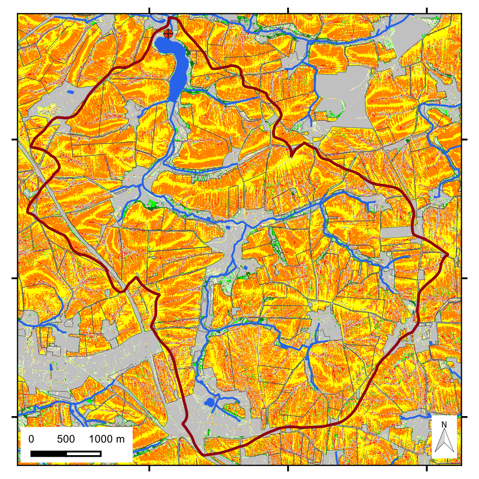
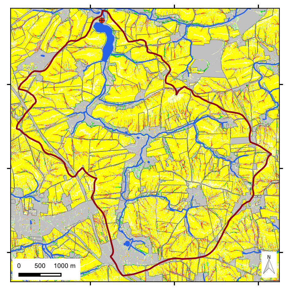
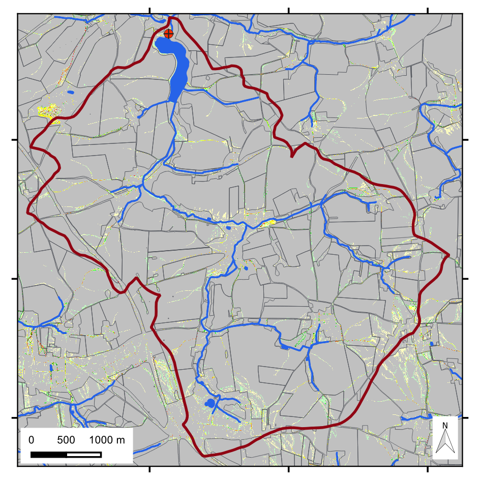
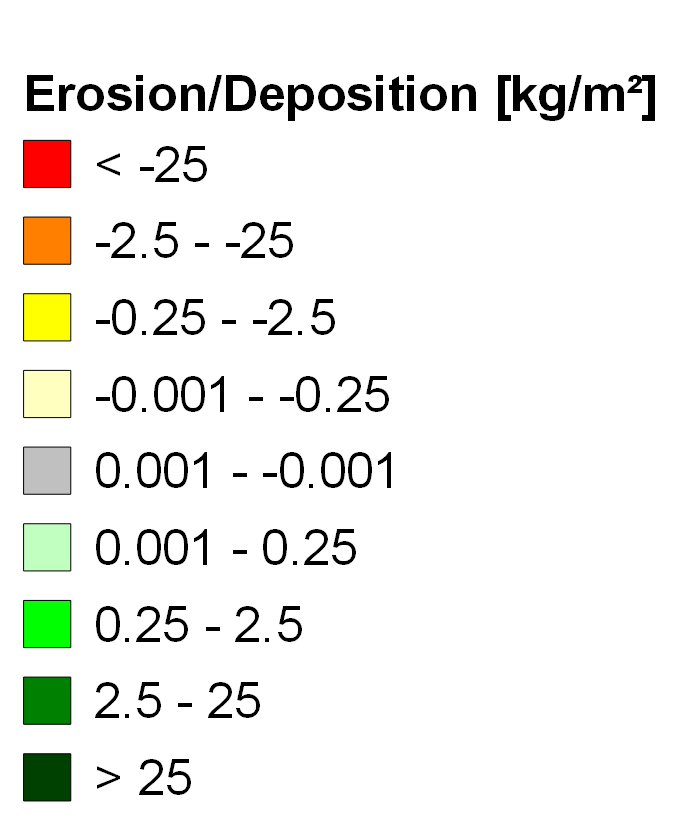
The state-wide map series shows erosion/deposition for the following
scenarios on the use and condition of arable land: Seedbed condition with conventional and conservation tillage, grassland use and seedbed condition with conservation tillage, in combina-tion with supplementary erosion con-trol measures (such as green strips, planting on deep lines).
Work steps
- Development and preparation of the necessary state-wide data basis of high-resolution input data for eros-ion modelling: land use data (ATKIS-DLM), soil data (BK50), precipitation data (KOSTRA- DWD-2010R) and relief data (ATKIS-DGM2/10).
Dealing with culverts and bridges in the digital terrain model of the state of Saxony was successfully resolved.
- Carrying out the simulations with EROSION-3D to create the state-wide scenario maps (spatial reso-lution: 10 m) for a 10-year and a 50-year heavy rainfall event. The modelling software was optimised to process very large data sets in a short time
Methodology
The development of the methodology for state-wide data processing as well as simulations in 2 m resolution for exemplary detailed analyses with further scenarios (e.g. strip-till, impact division, damming of a runoff channel) was carried out in the approx. 20 km² catchment area of the Baderitz reservoir in the Central Saxon Loess Hills.