Preview

Risk management system for soil erosion 
in Morocco

IPROconsult Logo

Pilot project to develop a risk management system for runoff and soil erosion caused by heavy rainfall as part of the public-private partnership project with the National Motorway Company of Morocco (ADM) and GIZ in Morocco

Hazard map for a section of motorway showing the derived catchment areas and sediment inflows

Project background and objective


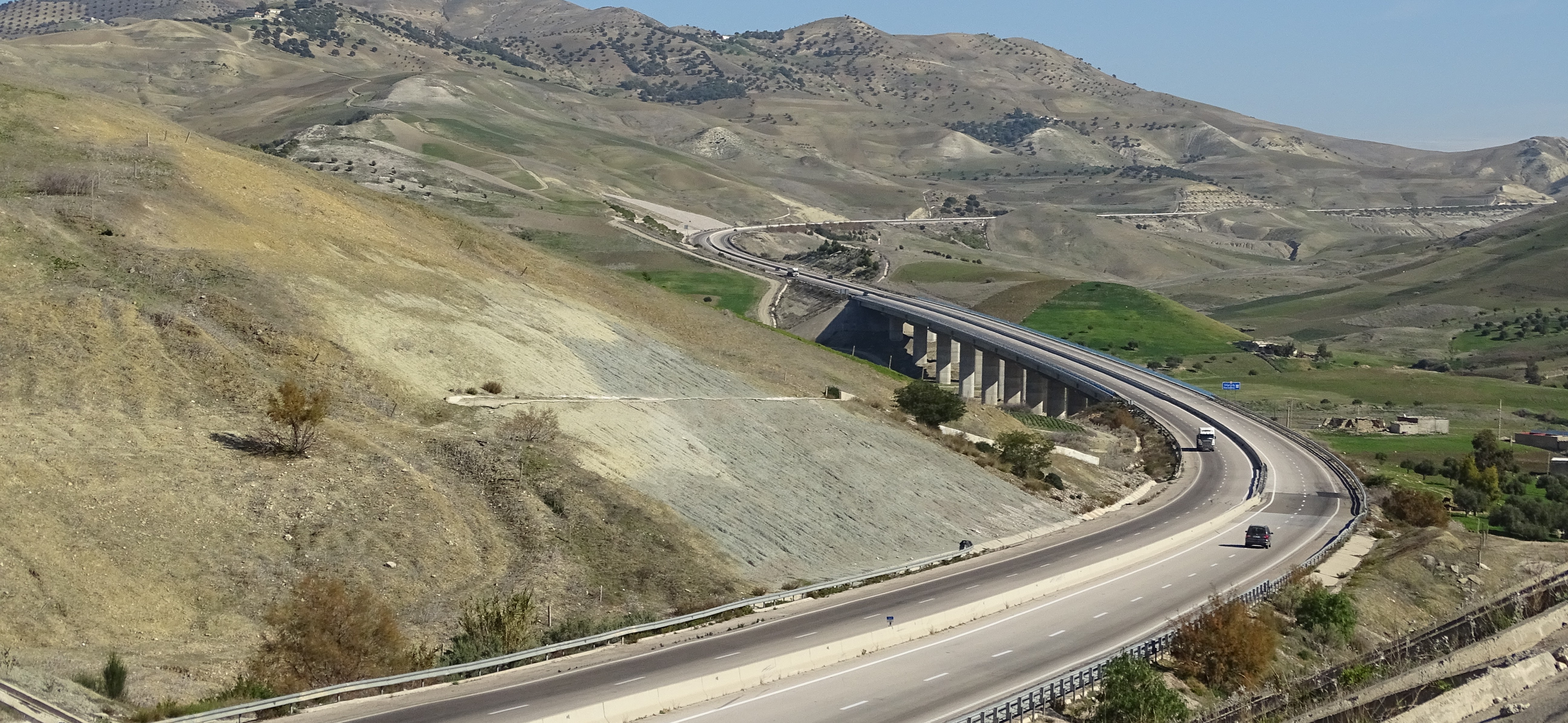
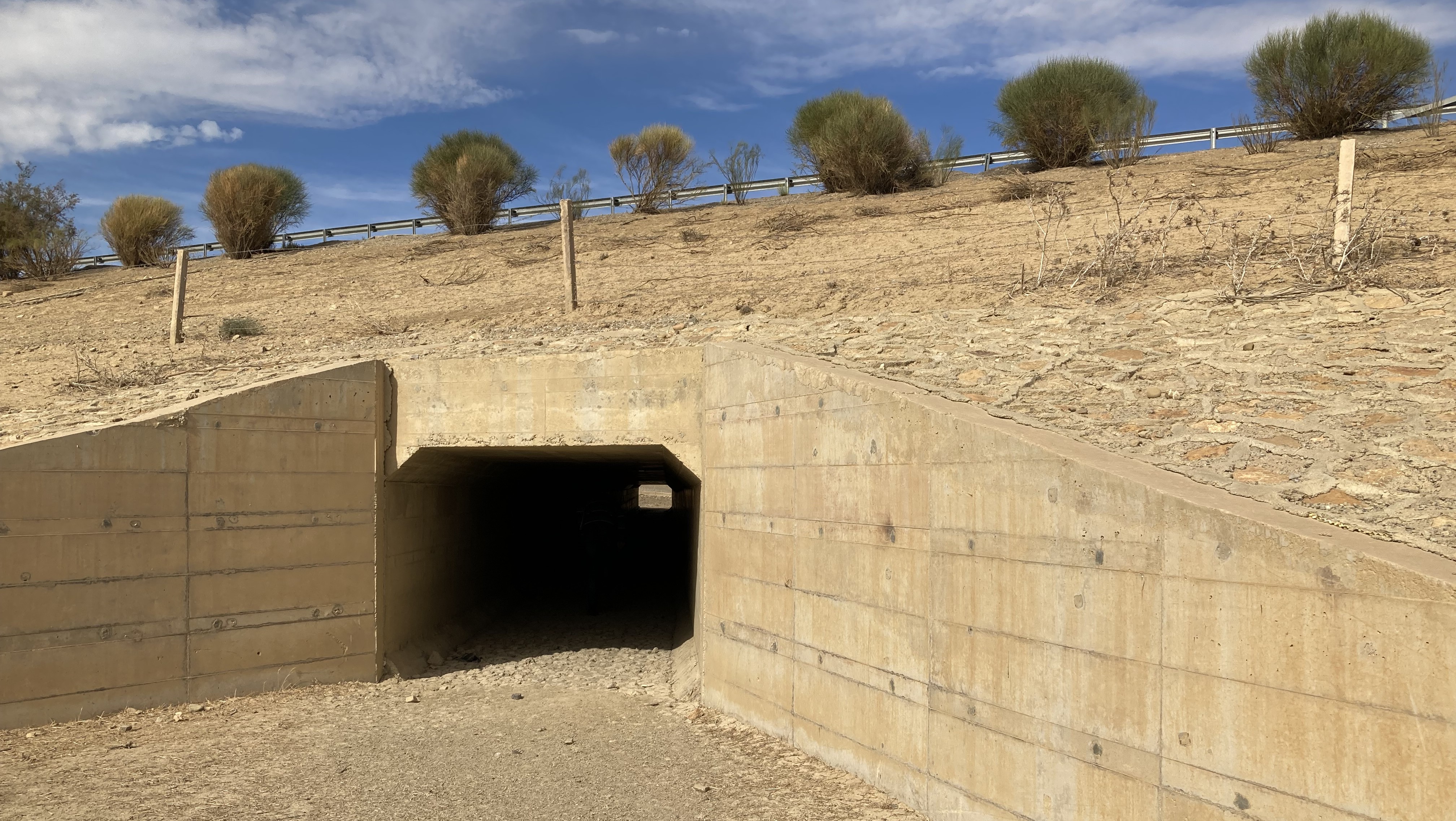
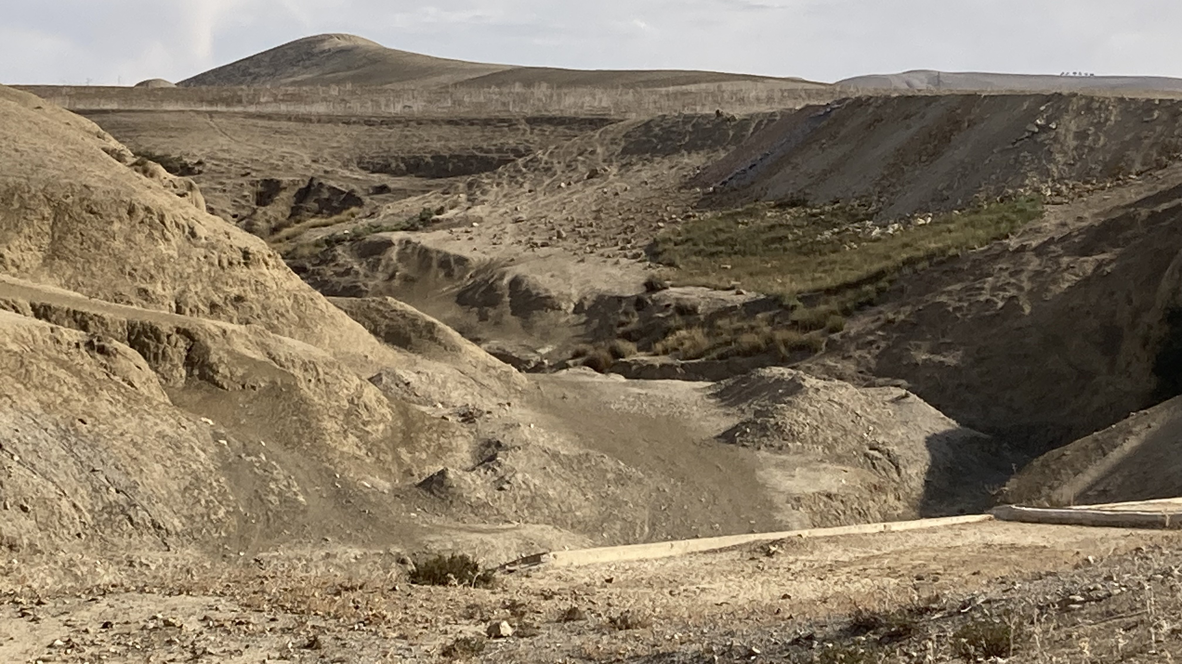
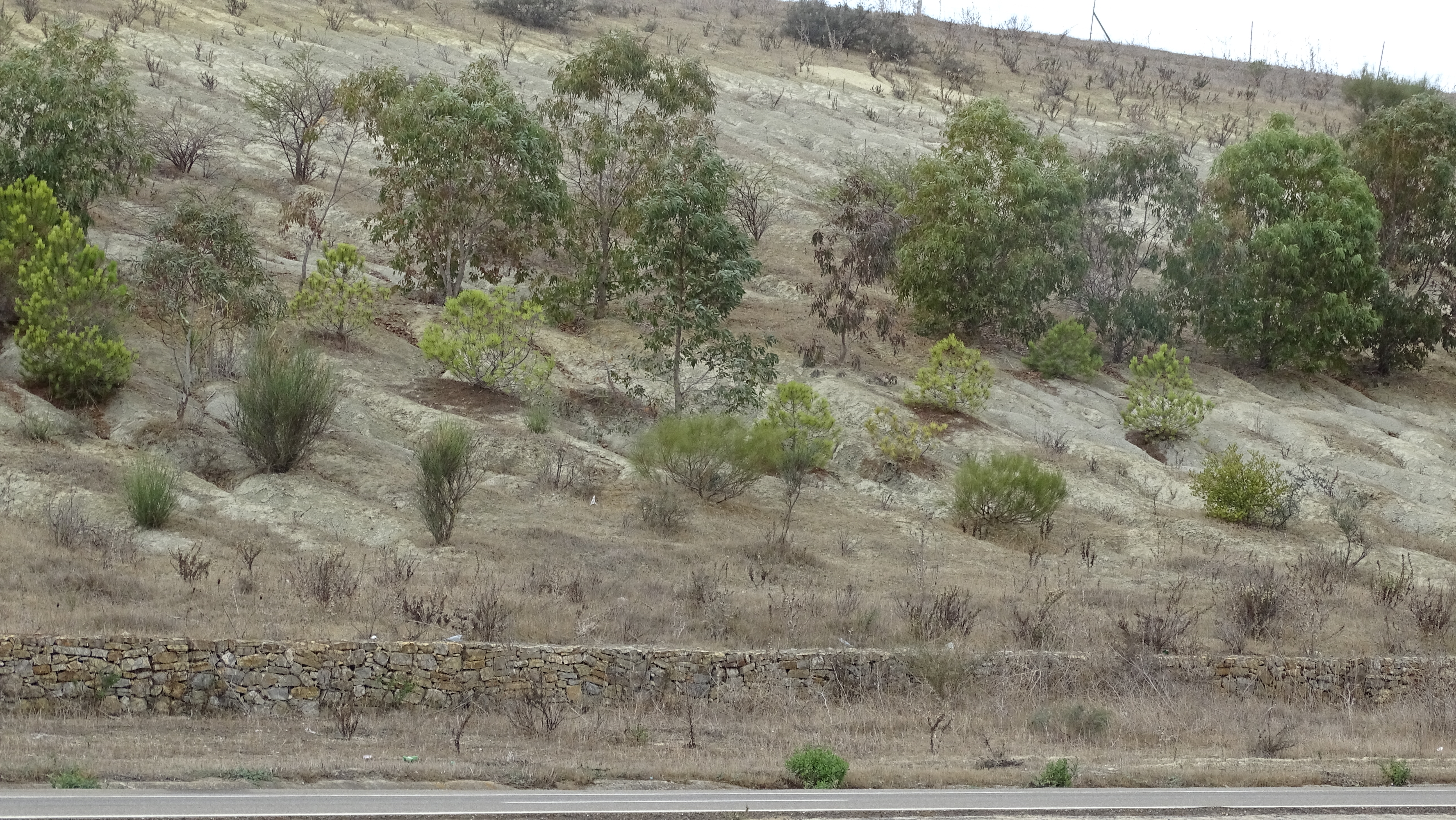
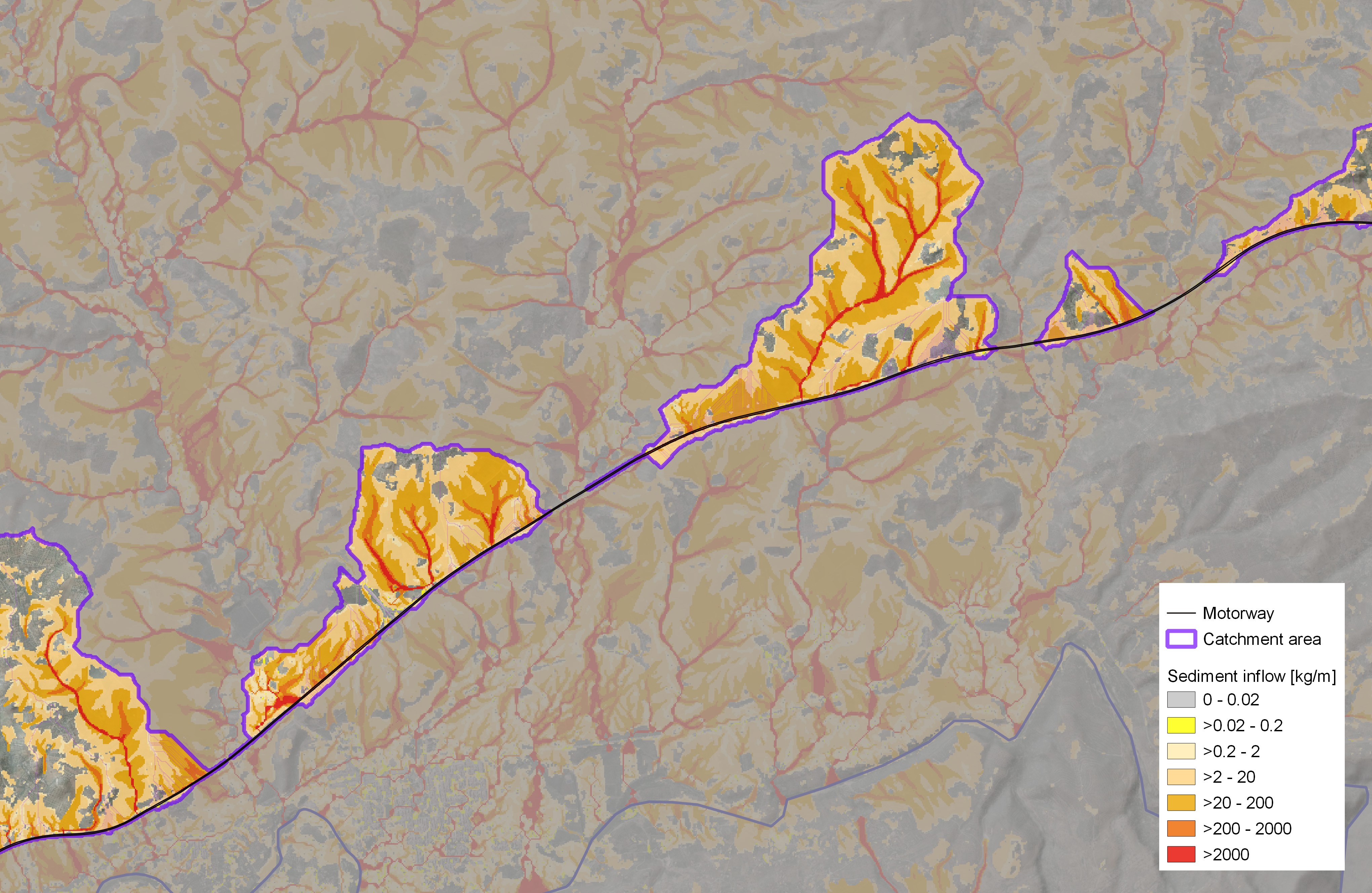
Due to the worsening climatic condi-tions in Morocco, an increased inten-sity of heavy rainfall events is to be expected. As a result, the risk of flooding and soil erosion for large areas in Morocco is increasing signi-ficantly. New planning instruments are needed to enable a reproducible assessment and prediction of soil erosion risk at different spatial levels.


The aim of the project was to develop a risk management system to reduce the hazard of soil erosion and runoff as well as the vulnerability of the motorway infrastructure in Morocco 

facing heavy rainfall by implementing targeted protective measures in the affected catchment areas.


The project was carried out in the two pilot regions of Larache-Tanger and Fès-Taza with the aim of developing an approach that could be applied nationwide.


Further partners in the project were the Agence Nationale des Eaux et Forêts (ANEF), the Agences de Bassin Hydraulique (ABH) of Sébou and Fès, the Institut National de la Recherche Agronomique (INRA) and the Direction générale de la Météorologie.

Divider
Client:

German Society for International Cooperation (GIZ)

Cooperation partner:

Société Nationale des Autoroutes du Maroc (ADM)

Services provided:

Risikomanagementsystem Bodenerosion

Execution period:

2021-2024


ENTWURF

Risk management system for soil erosion 
in Morocco

IPROconsult Logo
Motorway in the "Fès-Taza" pilot area

Work steps and results

  • Development of a multi-phase concept for the implementation of the erosion risk management system on the Moroccan motorways (including, among others, the identification of the protection goals, the implementation of a hazard, vulnerability and risk assessment, the planning of protection measures for risk reduction in the catchment areas)


  • Research, acquisition and collection of the necessary geodata (topography, heavy rainfall, soils, land use, agriculture, infrastructure) with the integration of satellite-based products for nationwide availability


  • Derivation of the water catchment areas of the motorway sections


  • Carrying out an analysis of the hazard of runoff and soil erosion using the process-based simulation model EROSION-3D


  • Identification of hotspot areas with a particularly high hazard


  • Analysis of the vulnerability of the motorway infrastructure and its drainage system for damage caused by runoff and sediment inflows


  • Identification of particularly vulnerable areas for vegetative slope stabilisation as a measure for erosion protection and risk reduction


  • Capacity development and know-how transfer for the operationalisation of the risk assessment approach as well as for the application and use of the web-based risk management system for erosion mitigation through workshops, seminars, training courses and specialist conferences

ENTWURF